 ru
ru  est
est  eng
eng 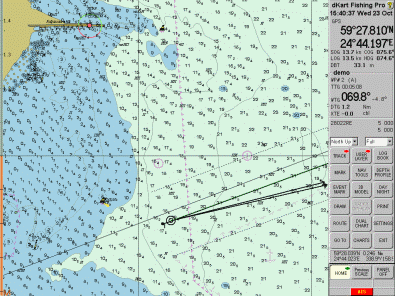
The purpose of dKart Fishing Pro
dKart Fishing Pro is the electronic chart system; specialized software system for marine navigational purposes.
dKart Fishing Pro will – in combination with GPS, speed Log, Compass, Echosounder, ARPA – accomplish the following tasks:
- display the own ship’s position on the electronic chart,
- track the ship movements and its deviation from the route line,
- automatically track and display targets,
- solve a number of navigational tasks and calculations.
Electronic navigational chart format
dKart Fishing Pro is an Electronic Chart System (ECS). When working with dKart Fishing Pro you are dealing with electronic charts.
The program operates with electronic charts of the following formats:
1. Vector electronic navigational charts of CM93v3 format of Jeppesen (C-MAP) production. Jeppesen charts provide almost worldwide coverage and are distributed on CD being updated every 4 months.
2. Vector electronic nautical charts (ENCs), produced by national HOs in accordance with S-57 IHO Transfer Standard for digital hydrographic data (hereinafter S-57). Charts of .dcf format of Morintech Ltd. production may be also distributed together with dKart Fishing Pro or by individual request.
dKart Fishing Pro provides automatic updating of CM93v3 and S-57 charts.
A vector electronic chart (ENC) offers advantages over the paper chart. In addition to the information transferred from paper charts, ENC may include information from any number of other sources – such as List of Lights and Notices to Mariners.
An electronic chart consists of objects. Each object belongs to an object class. An object class comprises items or objects with common main characteristics, such as: land areas, lights, restricted areas, depth contours, underwater rock, etc. An object is a single instance of an item belonging in an object class.
Each object is defined by two blocks of information – spatial and feature. Spatial information describes the geographical position of an object. Feature information describes its attributes. An object’s attribute describes a particular property of the object. For example: color of light, depth of spot sounding, name of land area are attributes of the corresponding objects.
The concept of objects and attributes makes it possible to use electronic chart data sets in computer applications which can analyze the momentary navigational situation, predict a future situation, and generate warnings to guide the mariner in avoiding dangers. dKart Fishing Pro is such an application.
In combination with a positioning system (GPS or other), ENC systems support computer analysis of navigational situation, as well as generation of warnings and alarms, thus contributing to the safety of navigation.
External devices and NMEA-0183 messages
dKart Fishing Pro performs a number of navigational tasks using computer power. To provide this service the program needs information about the position and movement of the ship. Global Navigation Satellite System (GNSS: Navstar–GPS + GLONASS), GPS, speed Log, Compass (gyro- or magnetic), Echosounder and ARPA are examples of navigational devices that are used as sources of external information for dKart Fishing Pro.
Communication between dKart Fishing Pro and external navigational devices is based on NMEA-0183 (IEC 61162 standard). This protocol defines the format of data to be used in navigational information exchange.