 ru
ru  est
est  eng
eng 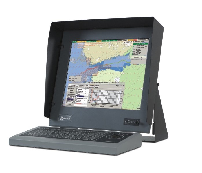
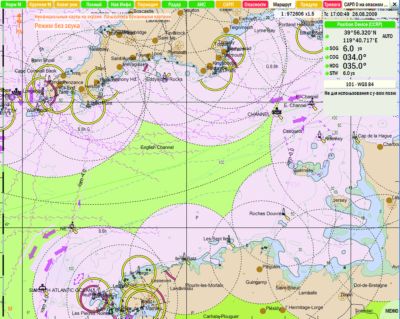
NavCom Voyager is a new generation of Electronic Cartographical Navigational Informational System
(ECDIS) which is designated for equipping sea-crafts committing international passages, for vessels of inland and mix voyages. Version for river vessels (ECDIS) is the System that is capable displaying the Cartography Navigational Information.
NavCom Voyager is the powerful navigational tool that allows to increase the safety level of navigation and carrying capability of vessels significantly.
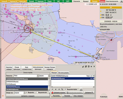
This is the first time when realized the task of automated study of passage – for the automated creation of a shortest route between set ports, and this
happens in just a few seconds. Further optimization of the rout is performed by the navigator in the interactive mode, together with downloading and
weather forecast, updated database of streams, automated check of cross with mapped jeopardy places and sectors which propose special navigational
conditions. Forecast analysis module allows avoiding the coming storm aforehand, although face the storm is inevitable — there is an option
to chose the optimal speed and heading combination for being in a gale conditions.
NavCom Voyager satisfies all the IMO MSC 232(82) Resolution conditions, and has been designed with consideration of modern domestic and international
studies in the field of shipping security, including the human factor effect. Unlike most of the other models, standard integration of NavCom
Voyager MB includes coupling module with radio-locator and imposing of radiolocation image onto the map, recommended by the Circular IMO SN255,
information displaying module AIS and ARPA, echo sounder, vessel’s weather station, weather forecast in any place of the World.
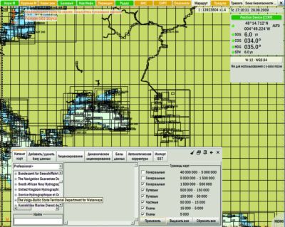
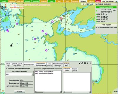
NavCom Voyager is capable to operate with official electronic maps which have been created by hydrographical services, as well as with the greatest
base of C-MAP Professional + electronic database. Since 2009, Jeppesen Marine Company has announced its new cartographical service:
This is combined worldwide database of all official maps of European cartographic Center Primar, and maps of Jeppesen Marine collection.
NavCom Voyager is one of the first ECDIS in the World that supports dynamic licensing of electronic maps: User pays for only the maps which in fact
were used while planning the voyage and during it. In the meantime, the traditional task of maps selection is not needed longer – captain can virtually
access the entire world database of electronic maps. The whole process of registration of «used maps» is automated and is under control of shipping
company. NavCom Voyager is designed and works in vessels with Russian and international crews. System supports the menu and all the messages
in Russian and English languages; whole documentation is bilingual too. While shipping in inland rives and seas of Russia, all the geographical and
water space names and text information in electronic maps are reflected in Russian language, upon the navigator’s choice. At once, during the port call,
for example, in China, it is capable to set Chinese for pilot convenience.
A modern amendment of navigational maps is not requirement of State Port Inspection only, but obligatory condition for shipping safety. Maps amendment
in NavCom Voyager is totally automated. With an eye to get the whole corrected information in a few minutes; it’s enough to press just a single
button for Navigator while connecting ECDIS with communication terminal of the vessel station ‘Inmarsat’, or even with mobile phone. In case
of deficiency of a direct connection with channel, the enquiry for correction of an existing database can be stored in memorystick and sent as an email
from any PC connected to the Internet. You will be responded in a few minutes.
For further amendment of maps, you need to insert the memorystick into ECDIS and activate the function of correction load. The cost of correction
is already included into subscription of cartography services of Jeppesen Marine. Navigators of river boats especially appreciate capabilities of NavCom
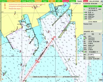
Voyager due to reflection of river maps in accustomed symbols, which is analogue to signs of Russian inland water ways. While navigating
in USA territorial waters, the system allows installing the reflection of conditional signs of floating navigation equipment in NOAA symbols, and start to get
use inches, fathoms instead of metrical system.
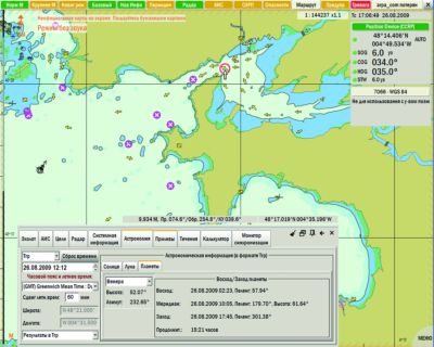
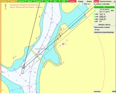
NavCom Voyager receives and reflects the coverage of GMDSS and boundary of search and rescue regions, as well as attributes of Coordination
centers of search and rescue and coastal stations of GMDSS. NavCom Voyager has been designed for various integrations of pilot bridge, with installation
of up to 5 control posts, with automatic databases synchronization.
The whole received navigational information coming from connected sensors might be translated to the external receivers/consumers, and this allows
installing additional monitors in pilot room or, for example, in passengers’ saloons.
We offer two versions of Navcom Voyager to be installed on to vessels of various types and classes. First, it’s a Monoblock unit with keyboard
(protection rate: IP44) and power supply unit. Monoblock equipped ultra bright display with protection against damage, bias=19″, front panel
protection rate: IP56, manual dimmer. The second version of Voyager SB is ultra bright display, 17″, 19″, 23″, front panel protection rate: IP56,
manual dimmer, system unit, protection rate: IP56, with keyboard (protection rate: IP56), and power supply unit. This set can also be supplied
in state-of-the art stand, to be mounted in a bridge. NavCom Voyager complex is certified by Russian River Register, Russian Maritime Register
of Shipping, and Ministry for Transport of Russian Federation.
| Accessories | ECDIS | Inland | ||
|---|---|---|---|---|
| Navcom Voyager MB | Navcom Voyager SB | Navcom Voyager MB | Navcom Voyager SB | |
| Bar Display 19 « | + | + | ||
| System unit | + | + | ||
| Display size (diagonal: 15 «, 17», 19 «, 23») | + | + | ||
| Bracket mounting | option | option | option | option |
| The switch signals NMEA | option | option | option | option |
| Radar Processor | + | + | option | option |
| Sunshield | option | option | option | option |
| Keyboard | + | + | + | + |
| Power Supply SIGMA-15SK (subject to change to another power supply approved by RMRS and RRR) | + | + | + | + |
| Battery 12V 7,5 A / h | option | option | option | option |
| Passport | + | + | + | + |
| Manual | + | + | + | + |
| Bracket mounting | option | option | option | option |
| Packaging products | + | + | + | + |
| Napalubnaya console | option | option | option | option |
| Table Console | option | option | option | option |
| The basic parameters | Type of equipment | |
|---|---|---|
| Navcom Voyager MB | Navcom Voyager SB | |
| Software Version | 50 | 50 |
| The range of supply voltage, V | 10.8 … 15.6 | 10.8 … 15.6 |
| Maximum current consumption A | 3.5 | 5.5 |
| Ingress Protection | IP44 | IP56 |
| Operating temperature, | -10 … 40 | -10 … 40 |
| Weight, kg | 6.8 | 8 |